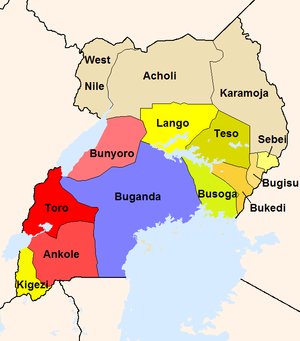
Subdivisions under the Ugandan Protectorate (1926 borders). (Click area to go to article.) The areas in red and blue hues had centralized kingdoms prior to British arrival, while the colonialists introduced centralized rule on the Baganda model to areas in yellow. Areas in khaki never had centralized kingdoms.