
File:Nailsworth railway station (site), Gloucestershire (geograph 7015946).jpg
Size of this preview: 800 × 600 pixels. Other resolutions: 320 × 240 pixels | 640 × 480 pixels | 1,024 × 768 pixels | 1,280 × 960 pixels | 1,600 × 1,200 pixels.
Original file (1,600 × 1,200 pixels, file size: 605 KB, MIME type: image/jpeg)
| This is a file from the Wikimedia Commons. Information from its description page there is shown below. Commons is a freely licensed media file repository. You can help. |
,_Gloucestershire_(geograph_7015946).jpg)
Summary
| Description |
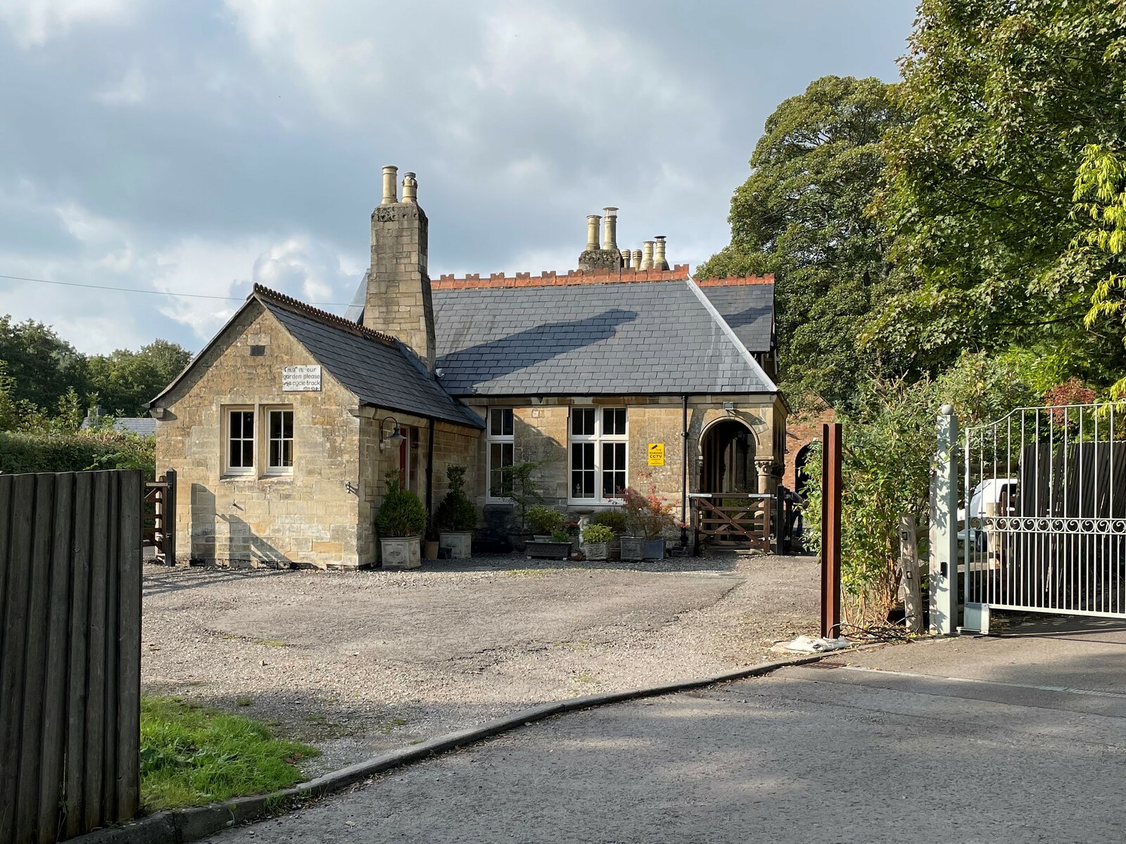
English: Nailsworth railway station (site), Gloucestershire Opened in 1867 by the Stonehouse & Nailsworth Railway, very soon to become part of the Midland Railway, as the southern terminus of the line, this station closed to passengers in 1947 and completely in 1966. View north west at the forecourt, and towards Woodchester and Stonehouse. The building, now a private residence, and platform (out of sight to the left of the building) were both well looked after when this image was taken. |
| Date | |
| Source | From geograph.org.uk |
| Author | Nigel Thompson |
| Permission (Reusing this file) |
Creative Commons Attribution Share-alike license 2.0 |
| Attribution (required by the license) | Nigel Thompson / Nailsworth railway station (site), Gloucestershire / |
| Camera location | | View this and other nearby images on: OpenStreetMap |
|---|
,_Gloucestershire_(geograph_7015946).jpg¶ms=051.698630_N_-002.219449_E_globe:Earth_type:camera_source:geograph-osgb36(SO84930001)_heading:292.00&language=en)
| Object location | | View this and other nearby images on: OpenStreetMap |
|---|
,_Gloucestershire_(geograph_7015946).jpg¶ms=051.698720_N_-002.219740_E_globe:Earth_class:object_type:object_source:geograph-osgb36(SO84910002)_heading:292.00&language=en)
Licensing

|
This image was taken from the Geograph project collection. See this photograph's page on the Geograph website for the photographer's contact details. The copyright on this image is owned by Nigel Thompson and is licensed for reuse under the Creative Commons Attribution-ShareAlike 2.0 license.
|
This file is licensed under the Creative Commons Attribution-Share Alike 2.0 Generic license.
Attribution: Nigel Thompson
- You are free:
- to share – to copy, distribute and transmit the work
- to remix – to adapt the work
- Under the following conditions:
- attribution – You must give appropriate credit, provide a link to the license, and indicate if changes were made. You may do so in any reasonable manner, but not in any way that suggests the licensor endorses you or your use.
- share alike – If you remix, transform, or build upon the material, you must distribute your contributions under the same or compatible license as the original.
File history
Click on a date/time to view the file as it appeared at that time.
| Date/Time | Thumbnail | Dimensions | User | Comment | |
|---|---|---|---|---|---|
| current | 10:14, 14 November 2021 | | 1,600 × 1,200 (605 KB) | Lamberhurst | == {{int:filedesc}} == {{Information |Description={{en|1=<b>Nailsworth railway station (site), Gloucestershire</b><br>Opened in 1867 by the Stonehouse & Nailsworth Railway, very soon to become part of the Midland Railway, as the southern terminus of the line, this station closed to passengers in 1947 and completely in 1966. View north west at the forecourt, and towards Woodchester and Stonehouse. The building, now a private residence, and platform (out of sight to the left of the building) we... |
File usage
The following pages on the English Wikipedia use this file (pages on other projects are not listed):
,_Gloucestershire_(geograph_7015946).jpg)