
File:Map of the Port of Tianjin's National Network of Dry Ports and Intermodal Trains.svg

Size of this PNG preview of this SVG file: 705 × 599 pixels. Other resolutions: 282 × 240 pixels | 565 × 480 pixels | 904 × 768 pixels | 1,205 × 1,024 pixels | 2,409 × 2,048 pixels | 1,000 × 850 pixels.
Original file (SVG file, nominally 1,000 × 850 pixels, file size: 277 KB)
| This is a file from the Wikimedia Commons. Information from its description page there is shown below. Commons is a freely licensed media file repository. You can help. |
Summary
| Description |
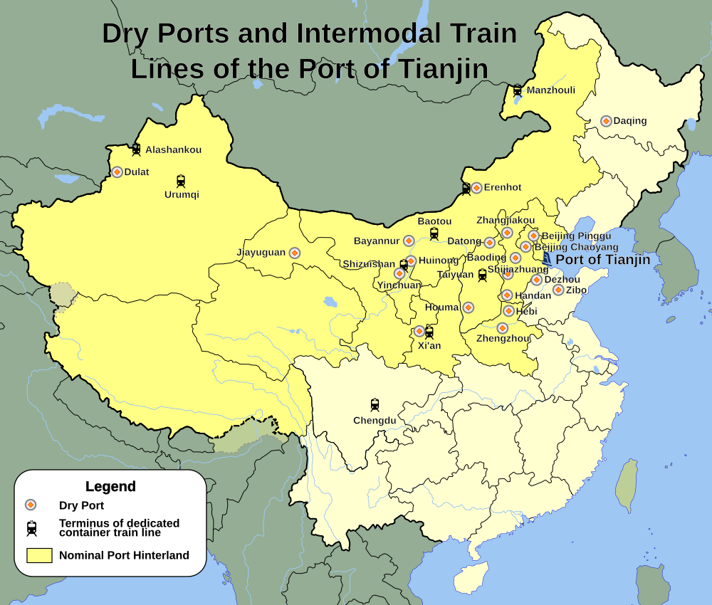
English: Simple map of the location of the network of dry ports associated with the Port of Tianjin, and some of the termini of the Port's dedicated intermodal container train lines. |
| Date | |
| Source | Own work |
| Author | Arrorro |
| Permission (Reusing this file) |
I, the copyright holder of this work, hereby publish it under the following license: This file is licensed under the Creative Commons Attribution-Share Alike 3.0 Unported license.
|
File history
Click on a date/time to view the file as it appeared at that time.
| Date/Time | Thumbnail | Dimensions | User | Comment | |
|---|---|---|---|---|---|
| current | 06:03, 6 September 2012 | | 1,000 × 850 (277 KB) | Arrorro | Increased size of icons for readability |
| 19:06, 30 April 2012 |  | 1,000 × 850 (277 KB) | Arrorro | Tweaks | |
| 18:51, 30 April 2012 |  | 1,000 × 850 (277 KB) | Arrorro | Increasing font size | |
| 18:18, 23 April 2012 |  | 1,000 × 850 (277 KB) | Arrorro | Tweaks for readibility | |
| 19:31, 18 April 2012 |  | 1,000 × 850 (274 KB) | Arrorro | Correcting an artifact, second try | |
| 19:18, 18 April 2012 |  | 1,000 × 850 (279 KB) | Arrorro | Correcting an artifact | |
| 18:29, 18 April 2012 |  | 1,000 × 850 (1.17 MB) | Arrorro |
File usage
The following pages on the English Wikipedia use this file (pages on other projects are not listed):