
File:1780 Bonne Map of Southern India, Ceylon, and the Maldives - Geographicus - IndiaSouth-bonne-1780.jpg
Size of this preview: 800 × 533 pixels. Other resolutions: 320 × 213 pixels | 640 × 427 pixels | 1,024 × 683 pixels | 1,280 × 854 pixels | 2,500 × 1,667 pixels.
Original file (2,500 × 1,667 pixels, file size: 995 KB, MIME type: image/jpeg)
| This is a file from the Wikimedia Commons. Information from its description page there is shown below. Commons is a freely licensed media file repository. You can help. |
| Rigobert Bonne: Carte De la Partie Inferieure de L'Inde en Deca du Gange Contenant L'Isle de Ceylan, Les Cotes de Malabar et de Coromandel, avec le Pays compris entre ces Cotes.
( |
|||||||||||||||||||||||
|---|---|---|---|---|---|---|---|---|---|---|---|---|---|---|---|---|---|---|---|---|---|---|---|
| Artist |
|
||||||||||||||||||||||
| Title |
Carte De la Partie Inferieure de L'Inde en Deca du Gange Contenant L'Isle de Ceylan, Les Cotes de Malabar et de Coromandel, avec le Pays compris entre ces Cotes. |
||||||||||||||||||||||
| Description |
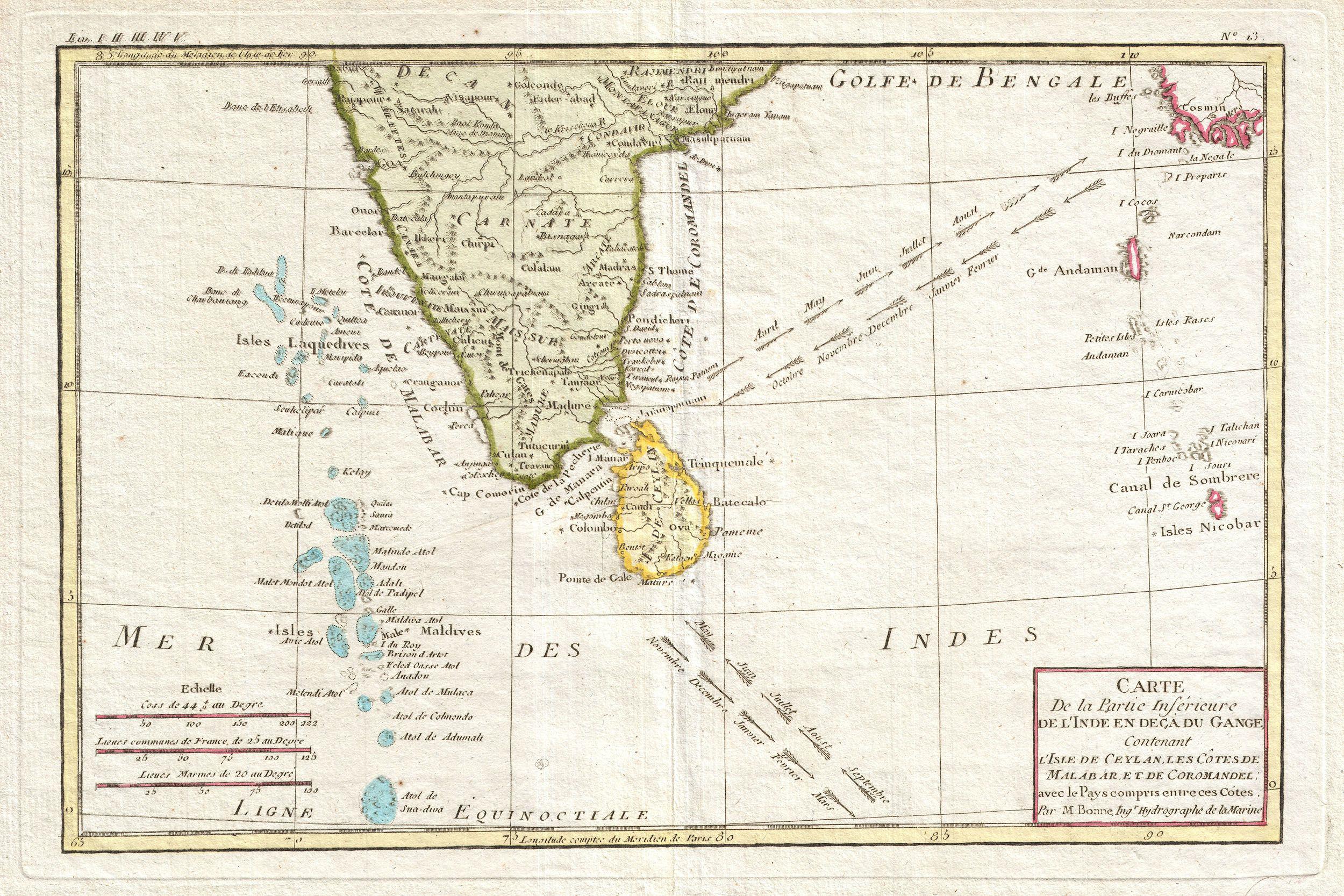
English: Attractive 1780 map of southern India by the French cartographer Rigobert Bonne. Covers from the Deccan plateau south as far as the Maldives and as far east as the Andaman and Nicobar Islands. Includes Ceylon or Sri Lanka. Shows the direction of the important Indian Ocean trade winds and their corresponding seasons. The regularity of the trade winds in the Indian Ocean generated active nautical trade routes well into antiquity. Published as plate no. L 3 in Bonne's 1780 Atlas de Toutes les Parties Connues du Globe Terrestre . |
||||||||||||||||||||||
| Date | 1780 (undated) | ||||||||||||||||||||||
| Dimensions | height: 8.5 in (21.5 cm); width: 13 in (33 cm) | ||||||||||||||||||||||
| Accession number |
Geographicus link: IndiaSouth-bonne-1780 |
||||||||||||||||||||||
| Source/Photographer |
Bonne, R., Atlas de Toutes les Parties Connues du Globe Terrestre, 1780.
|
||||||||||||||||||||||
| Permission (Reusing this file) |
|
||||||||||||||||||||||
File history
Click on a date/time to view the file as it appeared at that time.
| Date/Time | Thumbnail | Dimensions | User | Comment | |
|---|---|---|---|---|---|
| current | 01:39, 24 March 2011 | | 2,500 × 1,667 (995 KB) | BotMultichillT | {{subst:User:Multichill/Geographicus |link=http://www.geographicus.com/P/AntiqueMap/IndiaSouth-bonne-1780 |product_name=1780 Bonne Map of Southern India, Ceylon, and the Maldives |map_title=Carte De la Partie Inferieure de L'Inde en Deca du Gange Contenan |
File usage
The following pages on the English Wikipedia use this file (pages on other projects are not listed):
Global file usage
The following other wikis use this file:
- Usage on ar.wikipedia.org